 Colleyville and Hurst are nearing completion of the Cotton Belt Trail through their cities.
ArtistCarola and I went on a, short bike ride/breakfast date, to La` Madeleine's, this morning and I took the opportunity to check out the progress being made on construction of the trail.
The Cotton Belt Trail is a rail trail that runs from southwest to northeast and follows the historic Cotton Belt Railway from browning drive in North Richland Hills to William D. Tate Ave./ Ball St in Grapevine.
Formerly there were two breaks in the trail keeping it from being a continuous trail.
One break is over Bear Creek on the Grapevine/Colleyvillle/ Southlake borders.
View Cotton Belt Trail in a larger map
The other was the segment over Little Bear Creek from Colleyville at L.D.Lockett Road through Hurst to Precinct Line Road. This is the segment of the trail that is now about to be no longer a missing segment!
.
View Cotton Belt Trail in a larger map
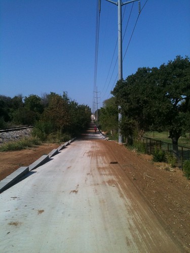
The trail is not quite finished yet. The only portion of the paving not finished is the last ten yards by Precinct Line Road. I don't envy the workers working in this Texas heat.
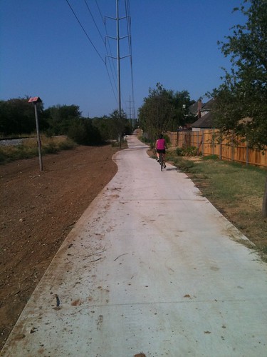
They have certainly done a wonderful job.
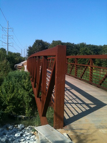
The Bridge that goes over Little Bear Creek is a beautiful peice of work and certainly befitting the City of Hurst's portion of this trail. I hope there will be much fanfare when the official opening happens. I know this portion of the trail will be put on many of my journeys around north east Tarrant county!
Here is a link to more Pictures
While it would be nice to see it finished, I suspect I won't ride it any more than at present which is almost never. You might ask why since I live in Colleyville? Well, except for the segment between Poole and Walmart, it goes nowhere I might be likely to go. I'm not the only one because traffic on the trail is almost nonexistent. It is sad.
ReplyDeleteLa Madeline is good stuff! We need more trees on these trails.
ReplyDeletePeace :)
Steve there is a walmart at the south end of the trail too!
ReplyDeleteExcept for a few feet where the trail crosses the RR tracks @ Glade, the trail is complete. My dog & I just walked it from Precinct line to John McCain/Hwy26 & back. At every major juncture, they have signs posted reading, "TRAIL CLOSED BY TXDOT DIRECTIVE". What's that about? That beautiful bridge mentioned above has (open) gates at either end with that obnoxious sign on them. Why is TXDoT supposed to be depriving taxpayers of access to this resource after picking the pockets of the taxpayers to build it?
ReplyDelete